

A Brief, Bulleted History of PBI
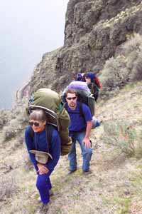
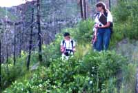
From old-growth forest to the desert, from the marbled murrelet to the harbor porpoise, from Alaska to the Sierra de Zenta, PBI conducted research in many different ecosystems and worked to protect many species since our quest to conserve biodiversity began in 1993.
In 2017, PBI was taken over by new leadership, which was unsuccessful. PBI's new leadership dissolved PBI in 2018.
We hope you enjoy this bulleted version of PBI's successful 20 years (prior to 2017). The history reads from 2016 and works its way back.
2016 E-newsletters
2015 E-newsletters
2014 E-newsletters
2013 |
2012 |
2011 |
2010 to 2008
While continuing to focus on research on Washington's wildlands, PBI ventures into South America, launching an ambitious effort to catalog the largest remaining wildlands on the continent. PBI also initiates its first marine research project.
- Launched the South American Wildlands and Biodiversity Project in 2010.
- Initiated the Washington Wildlands and Biodiversity Project in 2009.
- Launched the Harbor Porpoise Project in 2009.
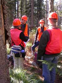
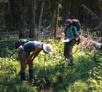
- Conducted a comprehensive forest health assessment and developed a forest management plan for Mount Spokane State Park and completed a series of wildlife studies, rare plant inventories and ecological assessments.
- Completed ecological assessments, botanical inventories and rare plant surveys of 17 state parks in eastern Washington.
- Conducted rare plant surveys, vegetation mapping and inventories for four state parks in western Oregon.
- Assisted Oregon State Parks with GIS analysis, mapping and preparation of a report on the Cottonwood Canyon complex in eastern Oregon.
- Completed a rare plant survey, vegetation mapping and inventory of the Bowen Mountain portion of the Methow Wildlife Area, Washington.
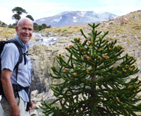
- Provided conservation science assistance to Parques Para Chile with the design of the Araucaria UNESCO Biosphere Reserve in the Andes mountain range, Chile and Argentina.
- Trained staff in Parques Para Chile in vegetation mapping using advanced techniques, wildlife habitat suitability modeling and conservation prioritization.
- Provided conservation assistance to Associacion Civil de Nosara, Costa Rica.
- Conducted botanical surveys of the Cedar River, Tolt River and Lake Youngs watersheds for non-native weed species for Seattle Public Utilities.
- Assisted the North Cascades Conservation Council and their American Alps Legacy Project with spatial analysis and mapping needs. We developed a web map for them that illustrated their proposal for expanding the North Cascades National Park.
2008 to 2003
Between 2003 and 2008, PBI worked with federal and state land management agencies throughout the United States and Canada to help establish conservation priorities and started our work in South America.
- Instructed in conservation science in the 2007 Cambridge University Cuchi Expedition in the Araucaria region of southern Chile.
- Conducted vegetation and rare plant surveys of 51 state parks and one Wildlife Area in Washington under contract with Washington State Parks.
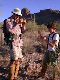
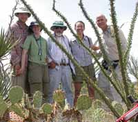
- Completed ecological assessments of native grass communities and riparian vegetation within the Sonoran Desert National Monument (BLM) and adjacent areas of the Barry M. Goldwater Range (USAF), Arizona. Multi-year ecological condition assessment and vegetation mapping of the natural communities of the Sonoran Desert National Monument (BLM) and adjacent areas of the Barry M. Goldwater Range (USAF) and Tohono O’odham Nation, Arizona.
- Completed an ecological classification and mapping of watersheds, streams and riparian areas and evaluation of the use of this data for conservation prioritization and decision-making in the Upper Columbia River basin to support salmon recovery effectiveness monitoring under contract with NOAA Fisheries, the Bonneville Power Administration, and the North Central Washington Resource Conservation and Development District.
- Completed forest health assessment and forest planning for wildfire risk reduction and forest health improvement in the eastern Mount Hood National Forest.
- Developed ecological and biological data for a comprehensive Conservation Needs Assessment of the Methow River Basin for the Methow Conservancy.
- Studied the causes, ecological effects and spatial distribution of alien plant invasions in the Chewuch Watershed, Washington.
- Assessed roads and roadless areas in Hiawatha, Ottawa, and Superior National Forests of the Great Lakes region of the United States for Defenders of Wildlife.
- Assessed forest condition and habitat quality for the northern spotted owl in Washington State for Washington Forest Law Center.
2003 to 1998
In 1998, Pacific Biodiversity Institute became an independent non-profit organization. In the next five years, PBI continued its earlier work while establishing ourselves as one of the premier conservation science organizations in the Pacific Northwest. We continued our landscape studies of wildlands, provided assistance to many conservation efforts and launched a few initiatives of our own.
- Analyzed and mapped the remaining roadless areas in the entire United States and its territories for the Pew Wilderness Center.
- Developed a conservation decision support system for conservation planning and a two-phased ecological assessment and comprehensive natural resource inventory of the Wenatchee River Basin, including development of new vegetation maps, and a comprehensive assessment of conservation priorities. This work was conducted for the Icicle Fund and its conservation partners, including Chelan-Douglas Land Trust, The Nature Conservancy, National Audubon Society and The Trust for Public Land.
- Completed the Puget Sound Basin Priority Salmon Habitat Assessment – a collaborative project with Trust for Public Land, Puget Sound Waterways and Dr. Chris Frissell, University of Montana.
- Completed a biodiversity assessment of the Loomis State Forest and mapping of forested wetlands for the Loomis Forest Campaign - a project of Conservation Northwest. We also provided a variety of specialized mapping services to Conservation Northwest to support the Loomis Forest Campaign.
- Initiated our conservation science internship program in 1998. Many young scientists from around the world worked with us for three to six months, learning conservation science methods while working on projects that made a critical difference in real-world conservation.
- Investigated wildfires burning in the western USA and assessing the relationship between wildfire behavior, forest ecology, landscape condition and land management history.
- Developed internet-based information sites to provide easy public access to information on wildfires, endangered species, and wildlands.
- Conducted several regional landscape level biodiversity analyses and conservation planning projects.
1998 to 1993
This is the period of the Methow Research Station of Sierra Biodiversity Institute. In these early years, we worked primarily on conservation-oriented landscape analysis, mapping wildlands, completing regional biodiversity assessments and providing aid to conservation organizations in Washington, Oregon and California.
- Completed a biodiversity assessment and established conservation priorities for the North Cascade Ecosystem in Washington State and British Columbia. This led to the design of an integrated reserve network encompassing all elements of regional biodiversity.
- Created maps of the current and historic distribution of old-growth redwood forests in Northern California and correlated this with marbled murrelet sightings. The marbled murrelet is an endangered seabird that nests in old-growth forests. Our work was presented as expert testimony in the historic legal case: Marbled Murrelet vs. Pacific Lumber which was eventually decided by the US Supreme Court and lead to significantly increased protection for both the marble murrelet and the old growth redwood forests.
- Published a map and report describing all the remaining unprotected and protected wildlands in Washington state.
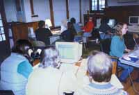
- Managed the development of the Conservation GIS StarterKit, a training manual now used throughout the U.S. and abroad for introducing new users to GIS applied to conservation problems.
- Worked with other conservation scientists to assess input into ICBEMP.
- Provided Conservation GIS support and training workshops for state agencies and conservation groups.
- Hosted a symposium on Conservation Priorities held at Seattle University.
Note: Pacific Biodiversity Institute is an IRS 501-(c) 3 non-profit organization based in Washington. Prior to 1998, PBI was the Methow Research Station of Sierra Biodiversity Institute, a project of the Tides Center.