The Eastern United States
While most of our work has been in the western USA, we have conducted studies of the effects of roads and the presence of roadless areas in all the National Forests in the Great Lakes region. To learn more about this work read these reports:
Hiawatha National Forest, Michigan, Effect of Roads and Roadless Areas, 2006.
Ottawa National Forest, Michigan Effect of Roads and Roadless Areas, 2006
Superior National Forest, Minnesota, Roads, Trails and Roadless Areas, 2004.
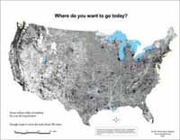
We also conducted a comprehensive study of wildlands across the entire USA, which mapped all the roadless areas and other wildlands on all state and federal ownerships in every state and US territory. Our report from 2001 covers all of the eastern states:
Copyright © Pacific Biodiversity Institute