
Services of Pacific Biodiversity Institute
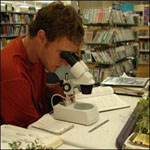
Pacific Biodiversity Institute had a 20-year history of conducting cutting edge conservation science and landscape analysis. Our services focused on providing conservation science, natural resource management and spatial analysis expertise to public and private entities. Our ability to provide scientific support was valuable at multiple levels: from conducting field surveys and inventories, to creating digital data repositories and customizing databases, to conducting statistical analyses and spatial modeling, to writing complex technical reports and disseminating information through GIS and web interface technologies. Pacific Biodiversity Institute offered top-of-the-line conservation science expertise with a track record of project excellence and success.
Ecology, Forestry and Wildlife Assessments
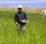
Pacific Biodiversity Institute has many years of experience performing habitat evaluations and ecology assessments:
- Rare Species Inventories (field inventories for rare/endangered species occurrence and distributions)
- Botanical Inventories (vascular plant inventories, exotic/noxious weed surveys, rare plant surveys)
- Vegetation Community Assessments
- Rangeland Health Inventories and Assessments
- Forest Health Inventories and Assessments
- Ecological Health Assessments
- Wildlife Biology and Wildlife Habitat Assessments
- More...
Conservation Planning and Resource Management
Pacific Biodiversity Institute is renowned for its resource management reports and conservation planning expertise in many natural resource fields:
- Wildfire and Fire Behavior Analysis
- Forest Health Prescriptions
- Grazing Impacts Analysis
- Conservation Decision Support Systems
- Development Impacts Analysis
- More...
Project Facilitation and Management
Pacific Biodiversity Institute has helped many organizations and individuals to gain experience in the technical and scientific aspects of environmental analysis.
- Coordination of Multiple Disciplinary Personnel
- Scientific/Environmental Data Management
- Technical Report Writing
- Environmental Education Outreach and Content Development
- More...
GIS, Remote Sensing, and Mapping
Pacific Biodiversity Institute offers a broad range of state-of-the-art mapping capabilities:
- Landscape Analysis
- Vegetation Community Modeling and Mapping
- Habitat Suitability Modeling and Mapping
- Future Scenarios Modeling and Mapping
- Customized Environmental Mapping
- More...
For more information:
![]() Download our Statement of Qualifications (PDF)
Download our Statement of Qualifications (PDF)
![]() Click here to download our brochure of services
Click here to download our brochure of services
Copyright © Pacific Biodiversity Institute