Wildlands and Biodiversity
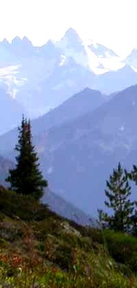
Starting in 1993 we mapped the roadless areas and other wildlands that are already protected as Wilderness or Park as part of a biodiversity assessment and establishment of conservation priorities for the North Cascade Ecosystem in Washington State and British Columbia. This work lead to the design of an integrated reserve network that encompasses all elements of regional biodiversity where the wildland complexes for the core of the reserve network. Beginning with this project, we took a novel approach, where we mapped roadless areas and other wildlands on all ownerships, public, private and tribal. Nature knows no borders, so why should wildland boundaries not be mapped across all ownerships? Political decisions will affect one ownership differently from another ownership, but the wildlife that depend on our wildlands do not know where one ownership begins and ends. So, at least from a conservation information and planning perspective, Pacific Biodiversity Institute believes that it is important to consider the entire landscape when defining and mapping roadless areas and wildlands.
Soon after the North Cascades project was finished we went on to map of all the remaining unprotected and protected wildlands in Washington State. We published a report (PDF), Unprotected Wildlands of Washington State in 1998 based on this work. Soon after this was finished, we mapped the unprotected and protected wildlands in Oregon, in a partnership with the Oregon Natural Resources Council. A map of Oregon's wildlands resulted from this project.
Soon after this, the Sierra Club asked us for help in mapping the remaining wildlands across the eight western states that Lewis and Clark traversed during their trek in the first part of the 19th century. We produced a series of maps for them, which were published in Sierra (their magazine and used in a variety of other venues celebrating the Lewis and Clark Expedition. A map of the wildlands in all 8 northwestern states with Lewis and Clark's route resulted from this project.
And a year later, Pacific Biodiversity Institute was commissioned by the Pew Wilderness Center to map the remaining wildlands on four federal ownerships (National Forest, BLM, National Park and National Wildlife Refuge) across the entire nation and its territories. This lead to another series of maps covering the entire nation and more detailed maps for each state. You can purchase hard copies of these maps on our maps and products page.
Questions and answers - what are wildlands and uninventoried roadless areas?
Click here for a web page explaining what wildlands are. This page also defines what inventoried and uninventoried roadless areas are and why they exist.
Studies of Wildlands by Pacific Biodiversity Institute
Pacific Biodiversity Institute has applied our extensive field-based knowledge and our spatial analysis expertise to mapping the extent and characteristics of wildlands in the western hemisphere. In 2008, we are launching two new wildland mapping initiatives in this area. To find out more about these specific initiatives, follow the links below.
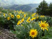
![]() Click here for a ten-year update of our Washington State wildland mapping project.
This page contains a new report discussing the biodiversity contributions of wildlands in Washington
and conservation priorities amongst wildlands in the state.
Click here for a ten-year update of our Washington State wildland mapping project.
This page contains a new report discussing the biodiversity contributions of wildlands in Washington
and conservation priorities amongst wildlands in the state.
![]() Click here to learn about our efforts to map all the wildlands in South America.
This is an ambitious project with our Latin American conservation partners.
Our wildland mapping project will share and disseminate information about the contribution of wildlands to global biodiversity.
Click here to learn about our efforts to map all the wildlands in South America.
This is an ambitious project with our Latin American conservation partners.
Our wildland mapping project will share and disseminate information about the contribution of wildlands to global biodiversity.
Copyright © Pacific Biodiversity Institute